
Bus route X21 in Birmingham goes from “The Square Peg” to “Bartley Green War Memorial”. In one direction or the other it serves 2 stops that it skips on the way back.
Which way bus X21 runs
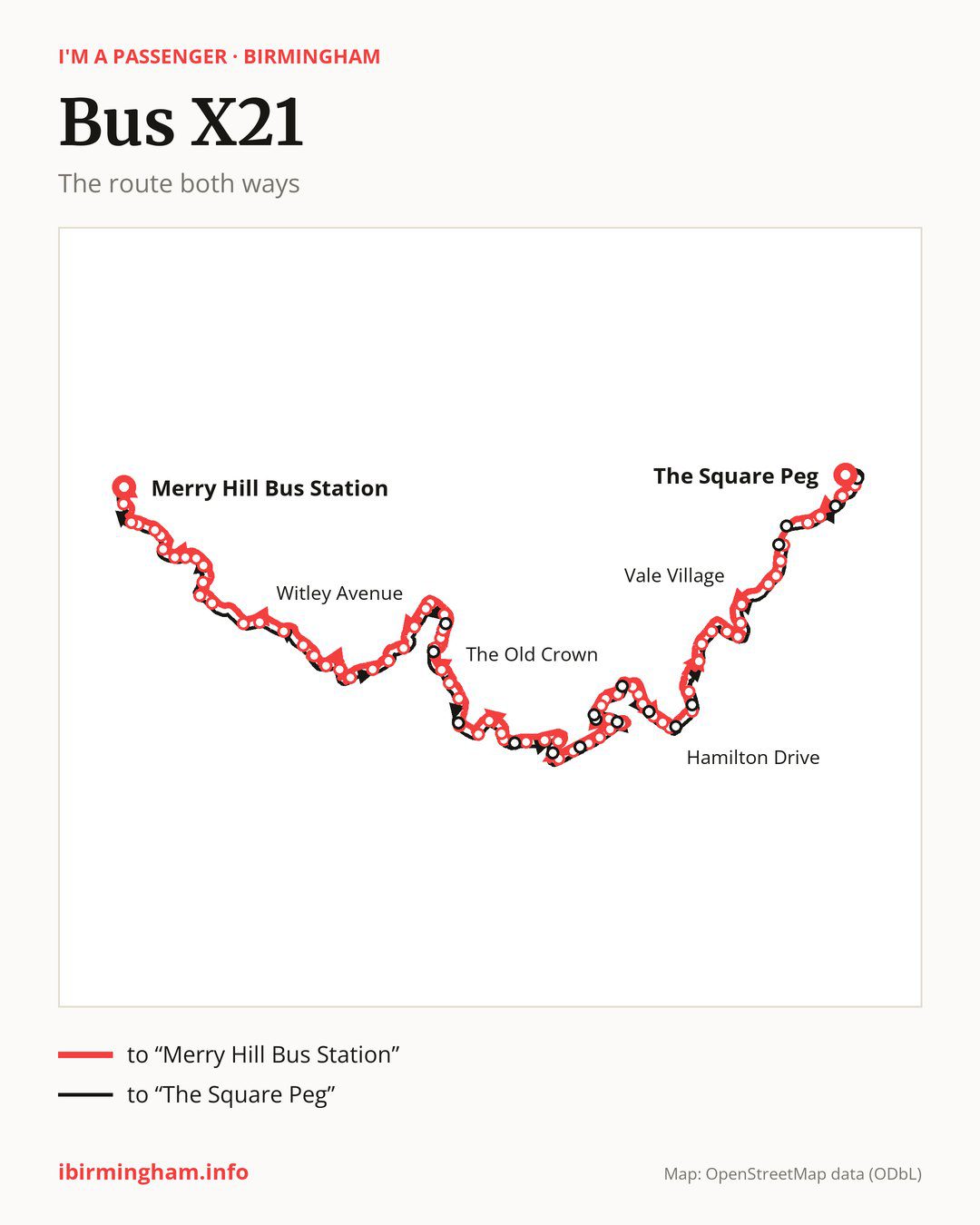
From “The Square Peg” to “Bartley Green War Memorial”: 43 stops. On the way: “Bus Mall”, “New Street Station”, “Ernest Street”, “Granville Street”, “Edencroft”, “Gilldown Place”, “Warwick Crescent”, “Aston House”, “Vale Village”, “Westmere”. Then “School of Education”, “University North Gate”, “Blood & Transplant Centre”, “University Station”, “The Oleaster”, “Gibbins Road”, “Lodge Hill Road”, “Hamilton Drive”, “Westhill Close”, “Springdale Gardens”. Then “Lodge Hill Cemetery”, “Woolacombe Lodge Road”, “Corisande Road”, “Kemberton Road”, “Kemberton Road Middle”, “Jervoise Road”, “Barcheston Road”, “Millennium Medical Centre”, “Princethorpe Road”, “Castlecroft”. Then “Ruckley Road”, “Quarry Road”, “Marston Road”, “Shenley Academy”, “Draycott Drive”, “Shenley Fields Centre”, “Bartley Drive”, “Monmouth Road”, “Brett Drive”, “Culford Drive”. Before “Bartley Green War Memorial”: “Bartley Green School”.
On the way back the bus takes a different route, from “Bartley Green War Memorial” to “The Square Peg” (47 stops). Only in this direction does it call at “Newman University”, “Longfield Road”, “Fulbrook Grove”, “Gregory Avenue”, “Weoley Castle Post Office”, “Weoley Castle Library”, “Alwold Road”, “Lodge Hill Cemetery Gates”, “College Walk”, “Rebecca Drive”, “George Road”, “Five Ways Station”, “Theatre Approach” and “Albert Street”. Only in the direction of “Bartley Green War Memorial” does it call at, among others, “Bus Mall”, “Edencroft”, “School of Education”, “Lodge Hill Road”, “Hamilton Drive” and “Springdale Gardens”. For the way back, board nearby: “Bus Mall” → “Albert Street” (150 m), “Edencroft” → “George Road” (100 m), “School of Education” → “University North Gate” (250 m) and “Lodge Hill Road” → “Rebecca Drive” (150 m). Towards “Bartley Green War Memorial”, board nearby: “Newman University” → “Monmouth Road” (250 m), “Longfield Road” → “Draycott Drive” (150 m), “Fulbrook Grove” → “Shenley Academy” (150 m) and “Gregory Avenue” → “Castlecroft” (100 m).
In practice: you can get to “Five Ways Station” on this bus only in the direction of “The Square Peg” and to “Theatre Approach” only in the direction of “The Square Peg”.
Left column runs down, right column runs up. Filled stops are served both ways, dashed ones only one way: 10 towards “Bartley Green War Memorial” and 14 the other way. Tap a stop to see its name.
Other routes along the way
Shared sections with other routes: between “The Square Peg” and “The Oleaster” it shares the road with route X20; between “The Square Peg” and “University Station” it shares the road with route X22; between “Monmouth Road” and “Bartley Green War Memorial” it shares the road with route 18.
Connections by stop, in route order:
- “The Square Peg”: buses 2, 4A, 5, 6, 7, 12, 13, 14, 16, 16A, 23, 24, 33, 45, 47, 51, 52, 61, 63, 65, 66, 67, 68, 74, 82, 87, 94, 95, 97, 97A, 101, 907, 936, 937, 997, 998, FD, X1, X2, X4, X5, X12, X14, X15, X51 and X64
- “Bus Mall” (only towards “Bartley Green War Memorial”): buses 2, 4A, 5, 6, 14, 16, 16A, 17, 17A, 23, 24, 33, 35, 45, 47, 50, 51, 60, 61, 63, 65, 66, 67, 68, 82, 87, 94, 95, 97, 97A, 907, 936, 937, 997, 998, FD, X1, X2, X4, X5, X12, X14, X15, X51 and X64
- “New Street Station”: buses 2, 4A, 5, 6, 16, 16A, 17, 17A, 23, 24, 35, 45, 47, 50, 60, 61, 63, 80, 82, 87, 97, 97A, FD, X1, X2, X4, X5, X14 and X15
- “Ernest Street”: buses 23, 24, 61, 63, 80, 82 and 87
- “Granville Street”: bus 80
- “Edencroft” (only towards “Bartley Green War Memorial”): bus 80
- “Warwick Crescent”: bus 1
- “Aston House”: bus 1
- “University Station”: buses 41 and 76
- “The Oleaster”: buses 41 and 76
- “Gibbins Road”: buses 11A, 55, 61, 63 and 76
- “Lodge Hill Road” (only towards “Bartley Green War Memorial”): buses 11A, 55, 61, 63 and 76
- “Hamilton Drive” (only towards “Bartley Green War Memorial”): buses 61 and 63
- “Westhill Close”: buses 61 and 63
- “Corisande Road”: bus 55
- “Kemberton Road” (only towards “Bartley Green War Memorial”): bus 55
- “Barcheston Road”: buses 39 and 39A
- “Millennium Medical Centre” (only towards “Bartley Green War Memorial”): buses 39 and 39A
- “Princethorpe Road”: buses 39 and 39A
- Stops from “Quarry Road” to “Shenley Fields Centre”: buses 39 and 39A
- Stops from “Monmouth Road” to “Bartley Green War Memorial”: bus 23
- “Newman University” (only towards “The Square Peg”): bus 23
- “Longfield Road” (only towards “The Square Peg”): buses 39 and 39A
- “Fulbrook Grove” (only towards “The Square Peg”): buses 39 and 39A
- “Weoley Castle Post Office” (only towards “The Square Peg”): buses 39 and 39A
- “Weoley Castle Library” (only towards “The Square Peg”): buses 39 and 39A
- “College Walk” (only towards “The Square Peg”): buses 61 and 63
- “Rebecca Drive” (only towards “The Square Peg”): buses 11A, 55, 61, 63 and 76
- “George Road” (only towards “The Square Peg”): bus 80
- “Five Ways Station” (only towards “The Square Peg”): buses 23, 24 and 80
- “Theatre Approach” (only towards “The Square Peg”): buses 16A, 23, 24, 61, 63, 82 and 87
- “Albert Street” (only towards “The Square Peg”): buses 2, 4A, 5, 6, 14, 16, 16A, 17, 17A, 23, 24, 33, 35, 45, 47, 50, 51, 60, 61, 63, 65, 66, 67, 68, 74, 82, 87, 94, 95, 97, 97A, 907, 936, 937, 997, 998, FD, X1, X2, X4, X5, X12, X14, X15, X51 and X64
Pages for these routes: bus FD, bus X12, bus X14, bus X15, bus X2, bus X20, bus X22, bus X4, bus X5, bus X64, bus 1, bus 2, bus 4A, bus 5, bus 6, bus 7, bus 12, bus 13, bus 14, bus 16, bus 16A, bus 17, bus 17A, bus 18, bus 23, bus 24, bus 33, bus 35, bus 39, bus 39A, bus 41, bus 45, bus 47, bus 50, bus 51, bus 52, bus 55, bus 60, bus 61, bus 63, bus 65, bus 66, bus 67, bus 68, bus 74, bus 76, bus 80, bus 82, bus 87, bus 94, bus 95, bus 97, bus 97A, bus 101, bus 907, bus 936, bus 937, bus 997, bus 998.
Passes and concessions
Which passes are available and who travels free is explained on a separate page: how to pay for public transport in Birmingham.
Questions and answers
Does bus X21 stop at “Five Ways Station”?
Only in the direction of “The Square Peg”: in the other direction it does not stop there.
Does bus X21 go to “New Street Station”?
Yes, in both directions.
Where can I change from bus X21 to another bus route?
Most routes stop at “The Square Peg” (2, 4A, 5, 6, 7, 12, 13, 14, 16, 16A, 23, 24, 33, 45, 47, 51, 52, 61, 63, 65, 66, 67, 68, 74, 82, 87, 94, 95, 97, 97A, 101, 907, 936, 937, 997, 998, FD, X1, X2, X4, X5, X12, X14, X15, X51 and X64) and “Albert Street” (only towards “The Square Peg”; 2, 4A, 5, 6, 14, 16, 16A, 17, 17A, 23, 24, 33, 35, 45, 47, 50, 51, 60, 61, 63, 65, 66, 67, 68, 74, 82, 87, 94, 95, 97, 97A, 907, 936, 937, 997, 998, FD, X1, X2, X4, X5, X12, X14, X15, X51 and X64). All other stops with connections are listed above.
Checked on 4 October 2026. Source of the route and stops: National Express West Midlands.