

Bus route 20 in Birmingham runs between “Sainsburys” and “Bearwood Road”.
Where bus 20 goes
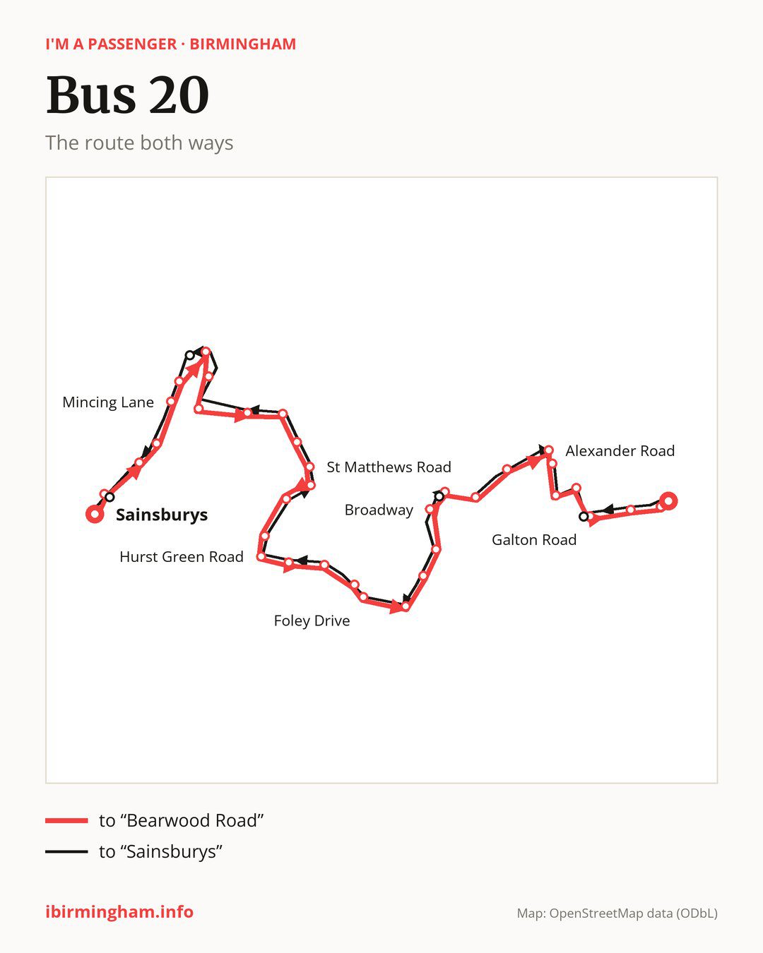
Towards “Bearwood Road”: 36 stops. After “Sainsburys”, the bus calls at “Oldbury Road”, “Station Road”, “Regis Heath Road”, “Mincing Lane”, “Uplands Avenue”, “Richards Close”, “Durham Road”, “Oldbury United FC”, “Griffin Industrial Estate”, “Causeway Green”. Then “Old College Avenue”, “St Matthews Road”, “Brook Road”, “Fairway Road”, “Mayfield Road”, “Hurst Green Road”, “M5 Flyover”, “Pitfields Close”, “Malvern Road”, “Kingsway”. Then “Tame Rise”, “Edward Road”, “Marshall Road”, “Broadway”, “Hill Top Road”, “Telford Close”, “Hurst Road”, “Alexander Road”, “Hamilton Road”, “Slatch House Road”. Before “Bearwood Road”: “Barclay Road”, “Galton Road”, “Wigorn Road”, “St Mary’s Church”.
On the way back, from “Bearwood Road” to “Sainsburys”: 37 stops. Only in this direction does it call at “Warley Park”, “The George”, “Birchfield Lane” and “Birmingham Road”. Only in the direction of “Bearwood Road” does it call at “Oldbury Road”, “Hill Top Road” and “Galton Road”. For the way back, board nearby: “Oldbury Road” → “Birmingham Road” (50 m), “Hill Top Road” → “The George” (50 m) and “Galton Road” → “Warley Park” (50 m). Towards “Bearwood Road”, board nearby: “Warley Park” → “Galton Road” (50 m), “The George” → “Hill Top Road” (50 m), “Birchfield Lane” → “Richards Close” (150 m) and “Birmingham Road” → “Oldbury Road” (50 m).
Left column runs down, right column runs up. Filled stops are served both ways, dashed ones only one way: 3 towards “Bearwood Road” and 4 the other way. Tap a stop to see its name.
Connections
On part of the route, between “M5 Flyover” and “Broadway” it shares the road with route 13; between “Oldbury Road” and “Uplands Avenue” it shares the road with routes 4, 4H and 4M; between “Kingsway” and “Broadway” it shares the road with route 54.
Connections by stop, in route order:
- “Sainsburys”: buses 3 and 3A
- “Oldbury Road” (only towards “Bearwood Road”): buses 3 and 3A
- “Broadway”: bus 22
- “Hill Top Road” (only towards “Bearwood Road”): bus 22
- “Telford Close”: buses 22 and 48
- “Hurst Road”: buses 22 and 48
- “Alexander Road”: bus 22
- “Hamilton Road”: bus 22
- “Galton Road” (only towards “Bearwood Road”): bus 48
- Stops from “Wigorn Road” to “Bearwood Road”: buses 11A, 12, 21, 22, 48 and 82
- “The George” (only towards “Sainsburys”): bus 22
- “Birmingham Road” (only towards “Sainsburys”): buses 3 and 3A
Pages for these routes: bus 3, bus 3A, bus 4, bus 4H, bus 4M, bus 12, bus 13, bus 21, bus 48, bus 54, bus 82.
Passes and concessions
Tickets, passes and concessions are covered on a separate page: how to pay for public transport in Birmingham.
Questions and answers
Does bus 20 go to “Station Road”?
Yes, in both directions.
Where can I change from bus 20 to another bus route?
Most routes stop at “Wigorn Road” and “St Mary’s Church” (11A, 12, 21, 22, 48 and 82). All other stops with connections are listed above.
Checked on 28 September 2026. Source of the route and stops: National Express West Midlands.